City-modelling ————— a geoinformation ML system for urban space modeling / digital master planning.
Cities are developing faster every day. The vast amount of data accumulated by the city on population movement and visitor numbers to urban socio-economic infrastructure facilities makes it possible to create qualitatively new models and elevate the process of city management and development to a new level.
To realize new opportunities in the digital development of Moscow, related to the accumulated urban data on visitor numbers to socio-economic infrastructure facilities, we have developed the geoinformation ML system City-modelling.
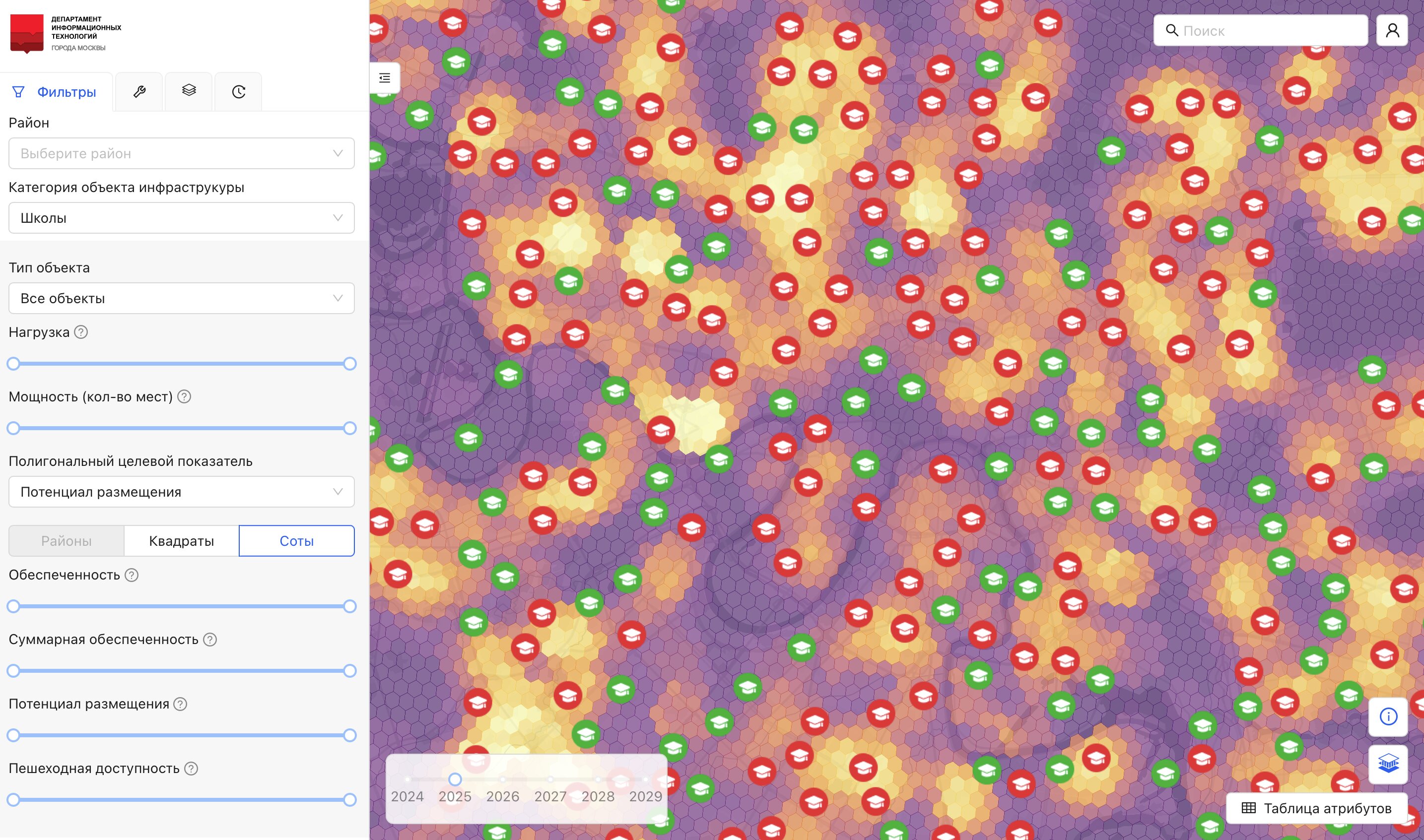
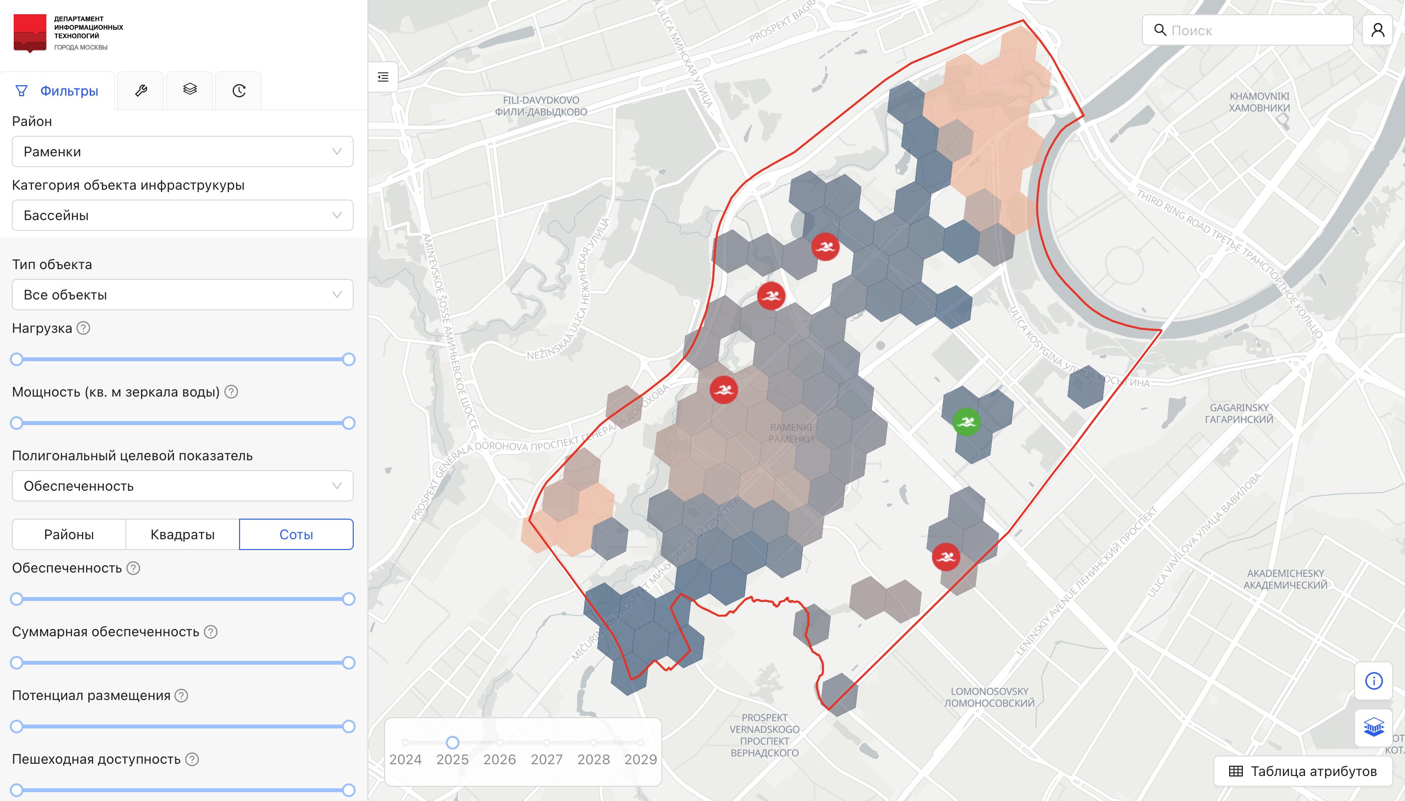
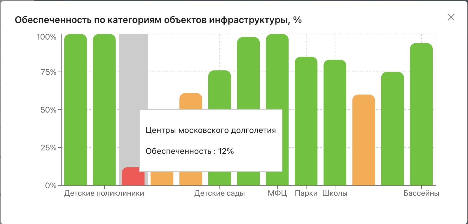
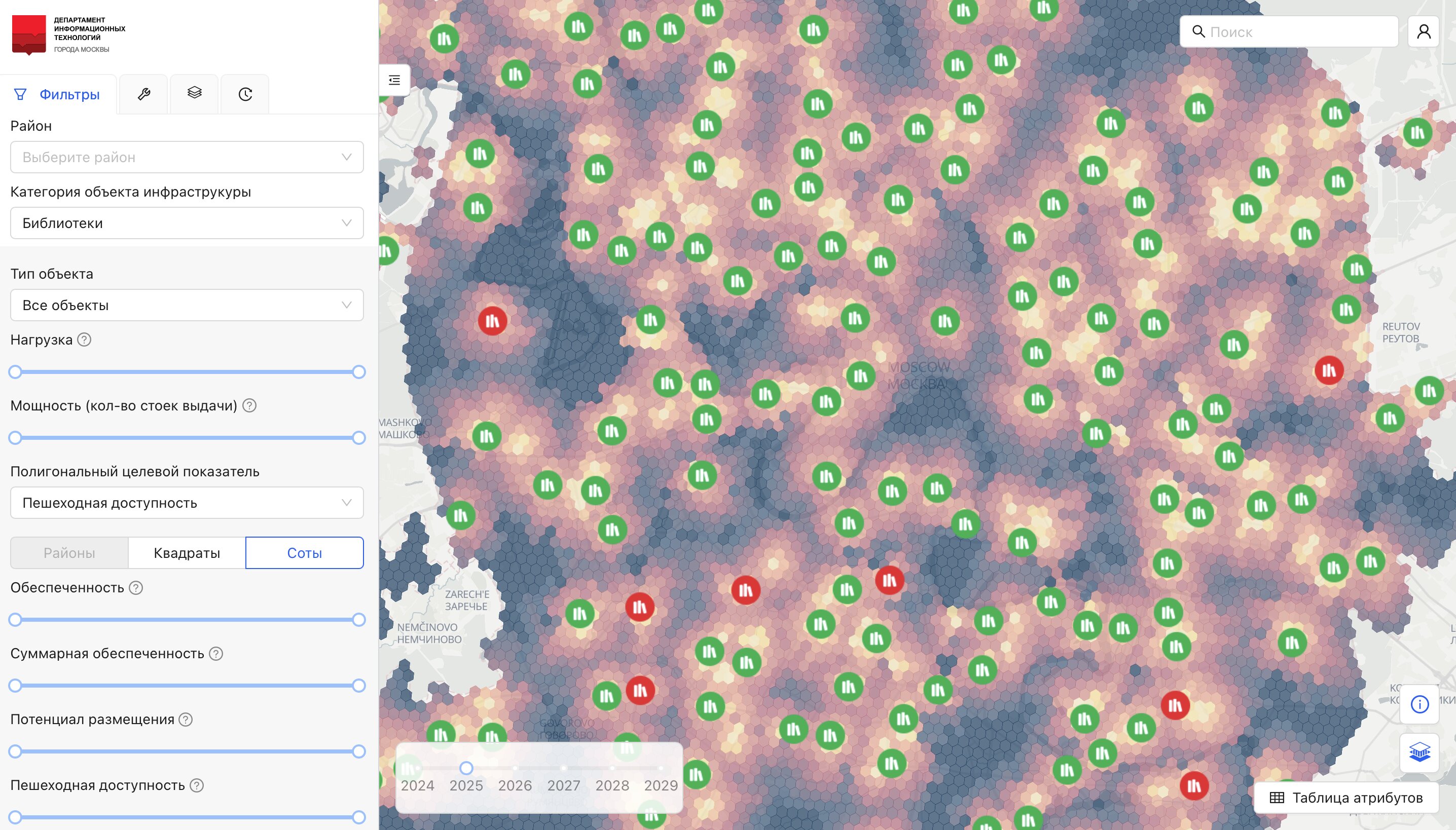
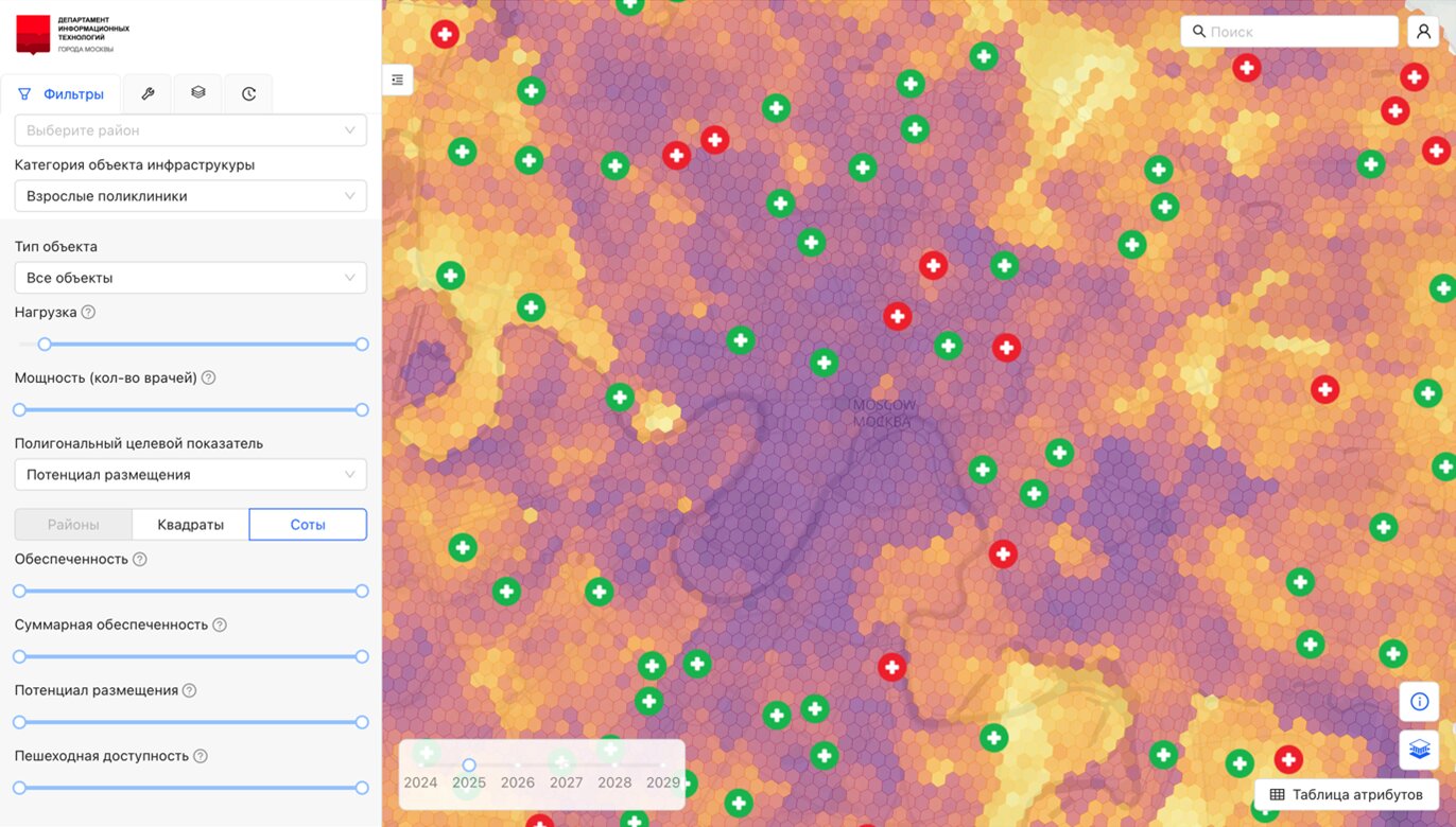
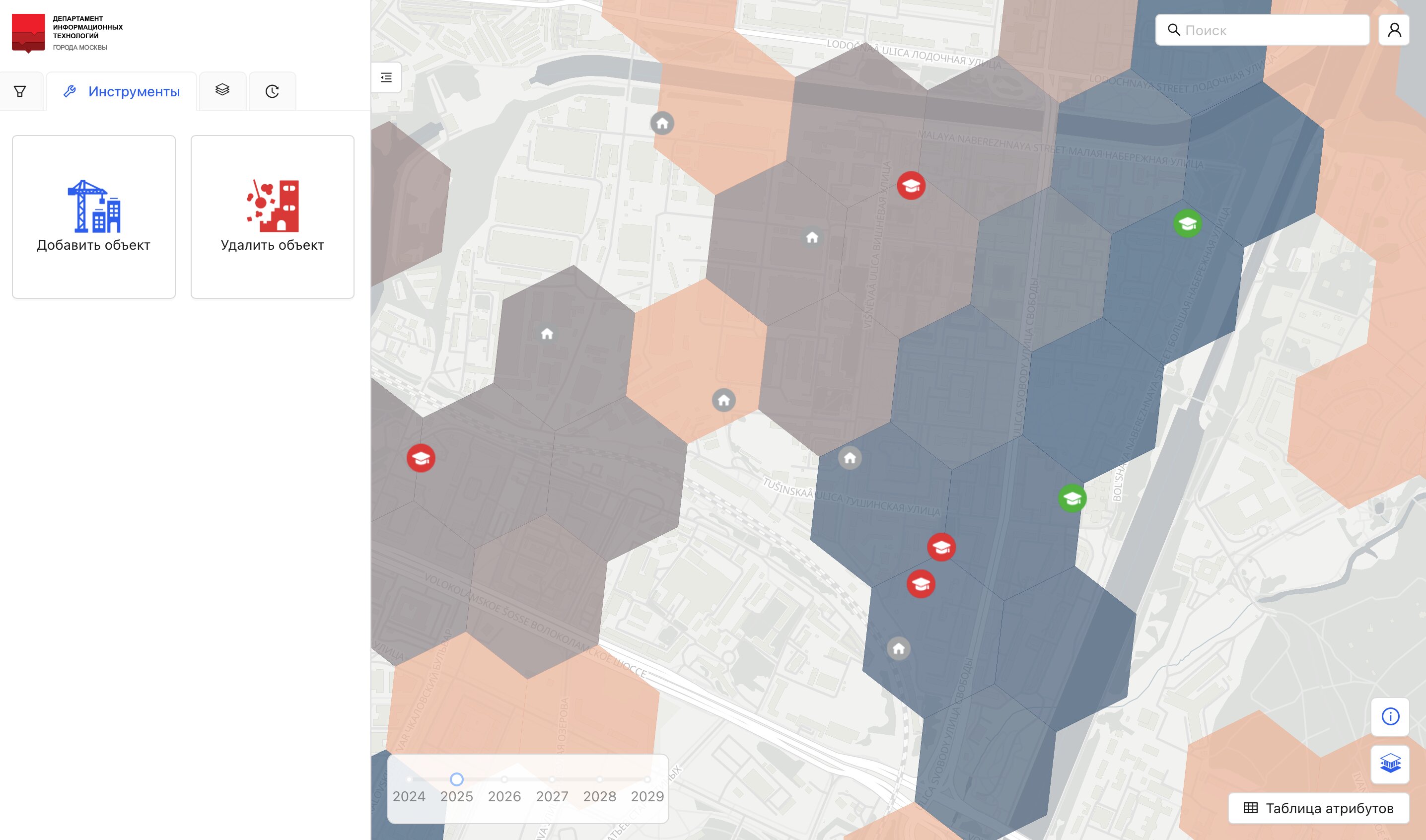
The system provides access to numerous layers with indicators that characterize the provision of territories with urban socio-economic infrastructure facilities, such as schools, swimming pools, clinics, etc. In total, the system presents 13 categories of facilities.
Among the displayed indicators are: load on infrastructure facilities, population provision, total population provision, pedestrian accessibility, and potential for placement.
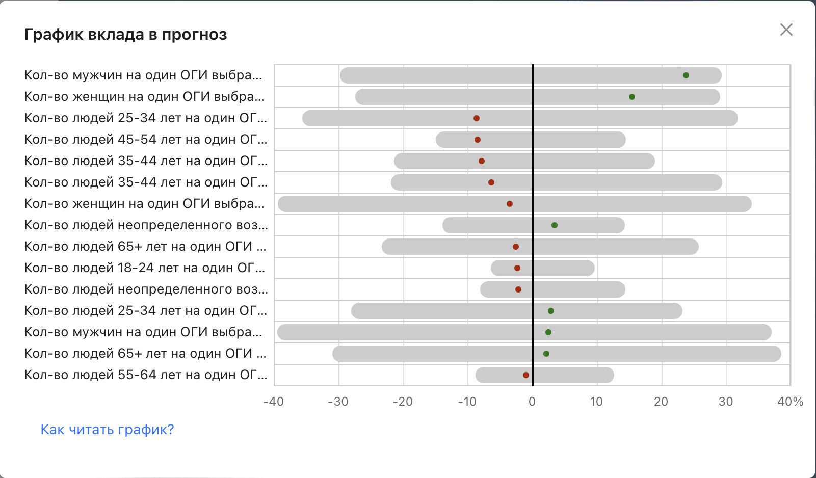
ML models, built on the basis of real retrospective data on facility visitor numbers and a variety of urban environment data, are used to calculate population demand.
Based on data for planned renovation and the introduction of new commercial housing, all indicators are calculated several years in advance so that decisions can be made with future changes in mind.
The main feature of the system is the ability to model urban space by performing simulations of the construction and demolition of infrastructure facilities or residential buildings and recalculating all indicators online based on these actions.
The system can answer the question "what if?" in a few seconds. After studying the current situation with the distribution of provision indicators, you can start experimenting with changing the urban space. You can build a new school or a multifunctional center in areas with low provision and see what the load on the new facilities will be, how much the load on existing facilities will decrease, how much the provision for the local population will increase, and so on.
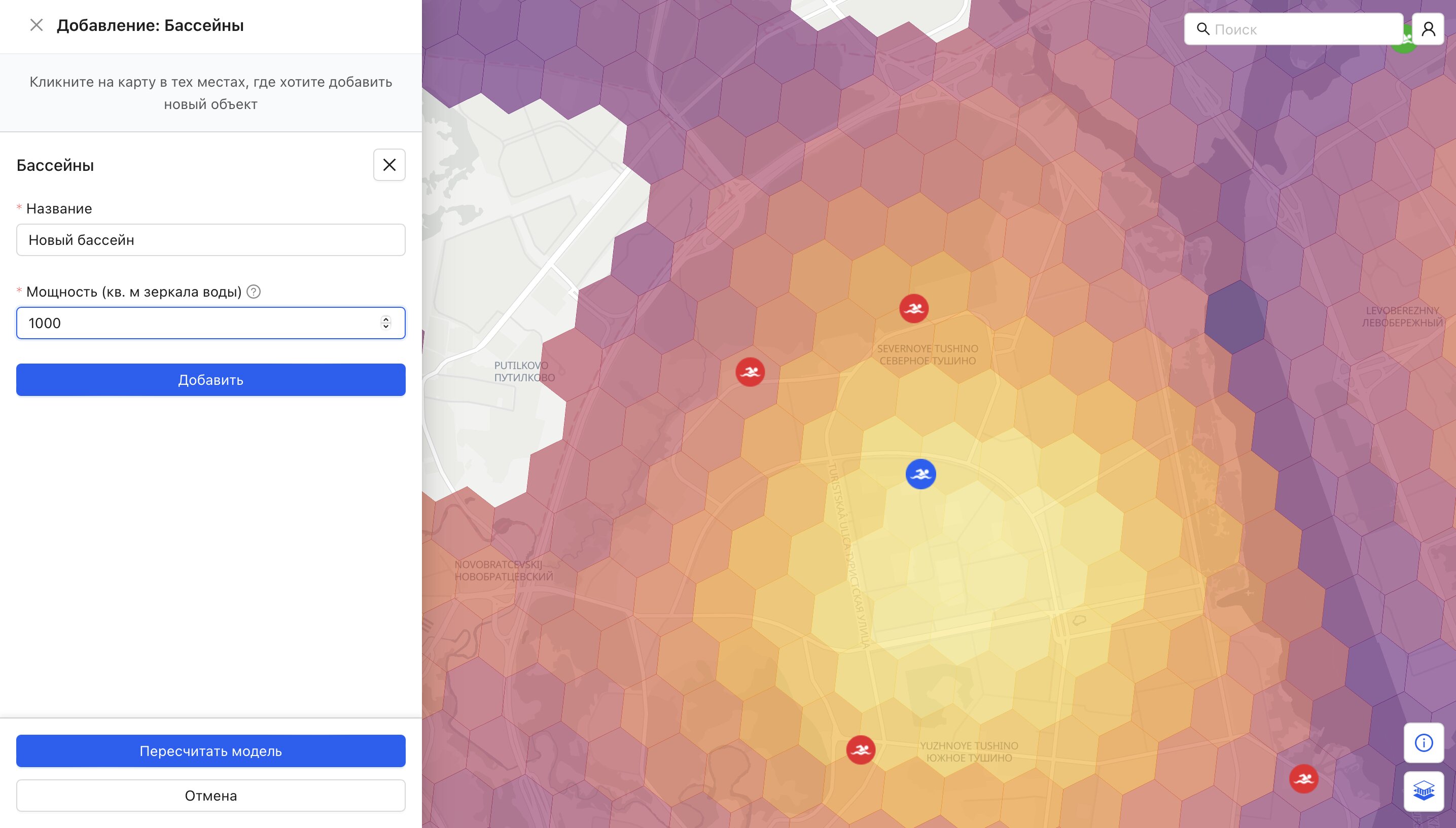
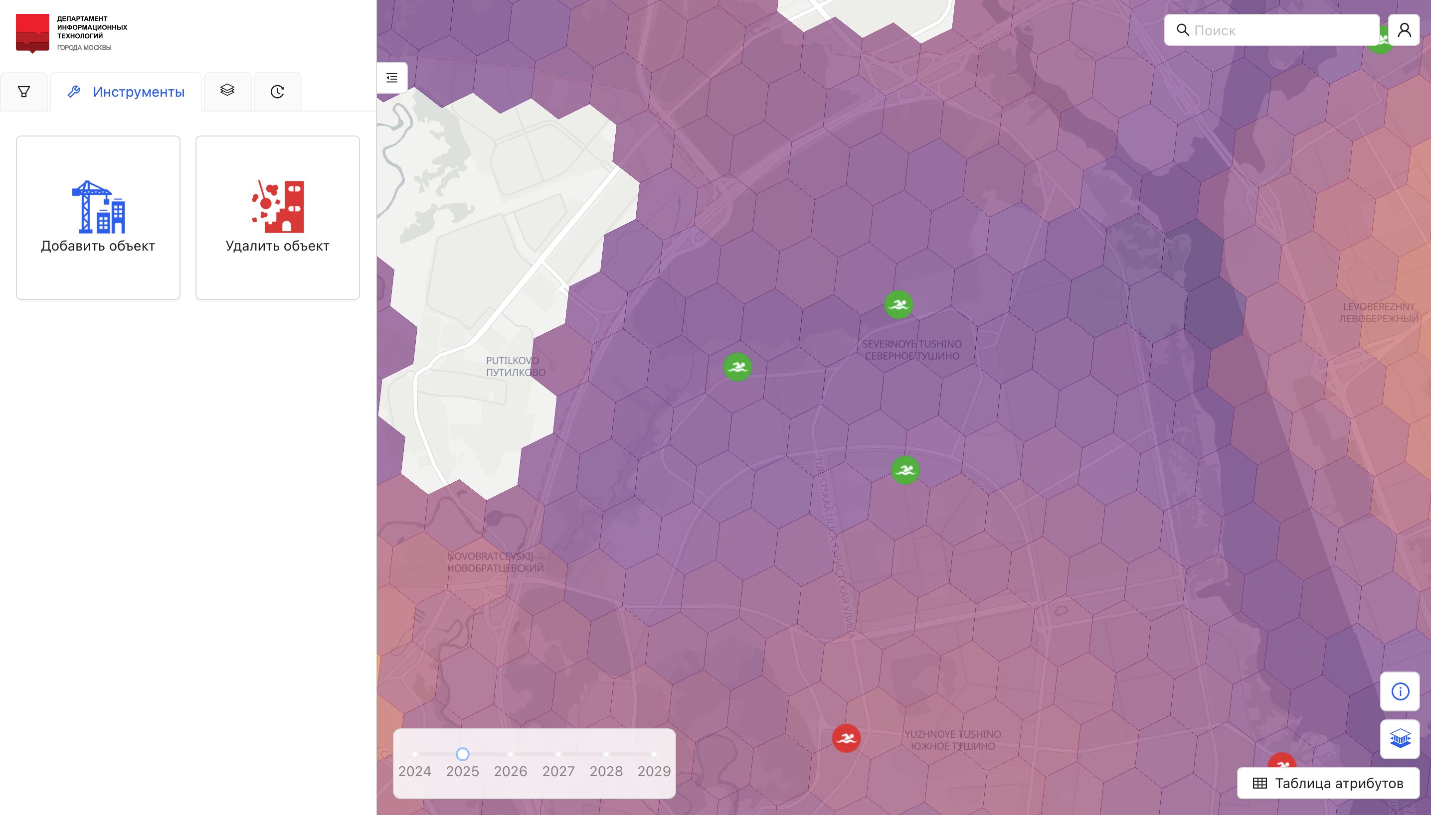
For example, by selecting the Swimming Pools category, you can see the overload of existing facilities in the Severnoe Tushino district and, consequently, the high potential for placing new ones in this area of the city.
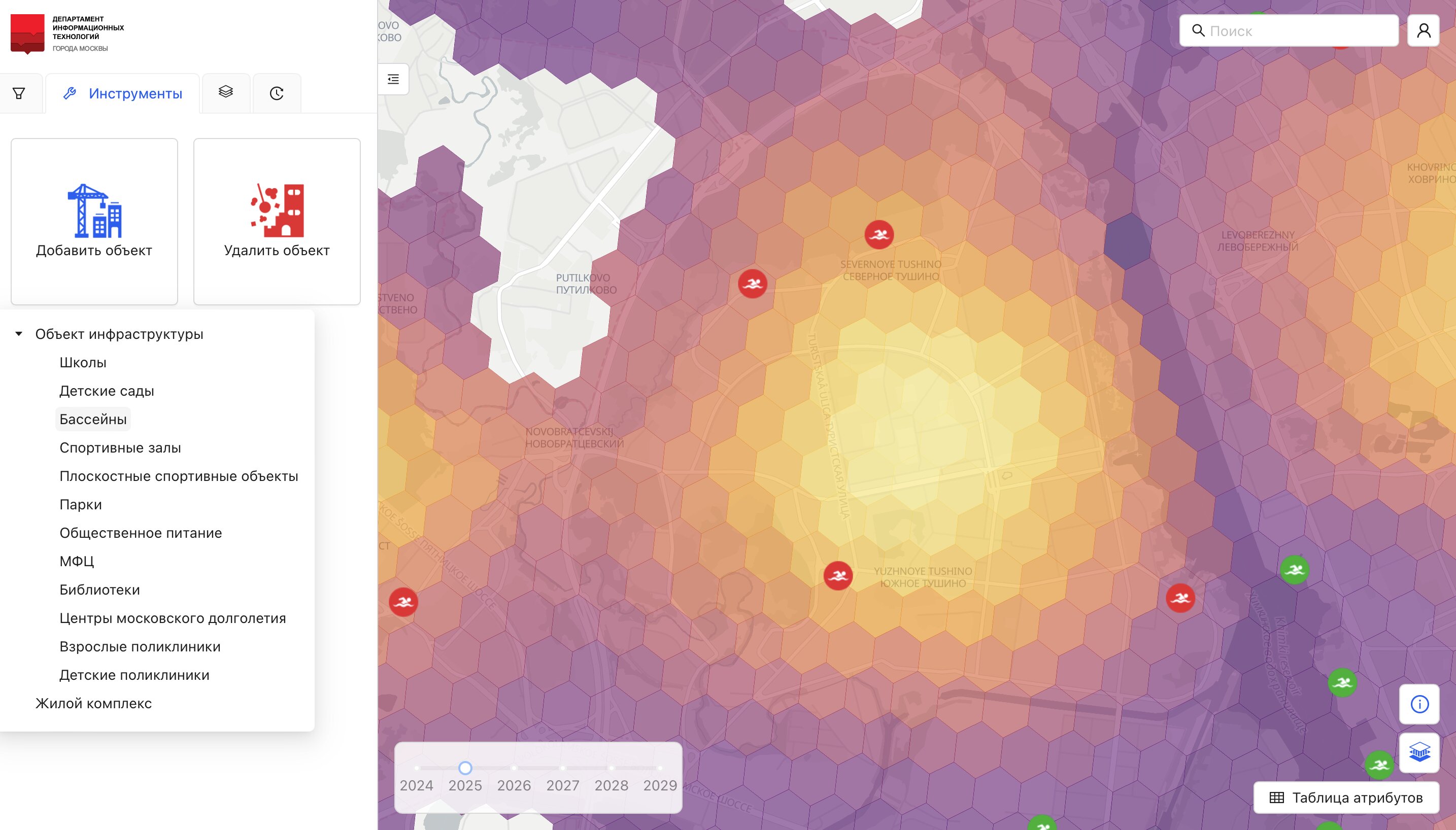
Let's build a new large swimming pool in the center of the Severnoe Tushino district, specifying its name and capacity. Within a few seconds, the indicators will update, taking into account the newly built facility. The load on the new pool will be 94%, the load on the two overloaded pools will normalize, and the situation in the district related to the pool deficit will stabilize.
During such a simulation, the data for each cell and each pool point is first updated based on the changes made by the user. Then, the previously trained ML model is applied to the updated dataset.
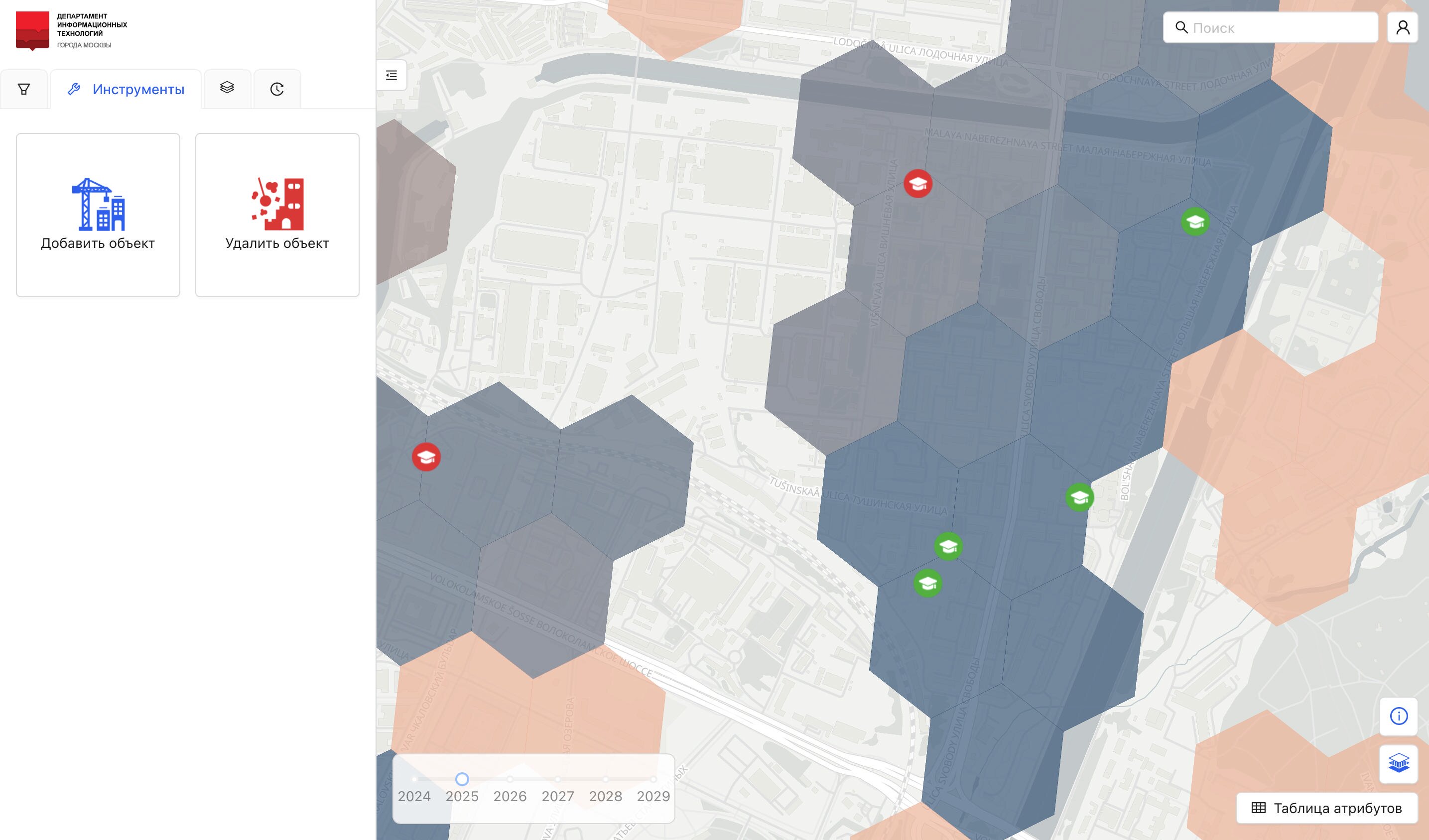
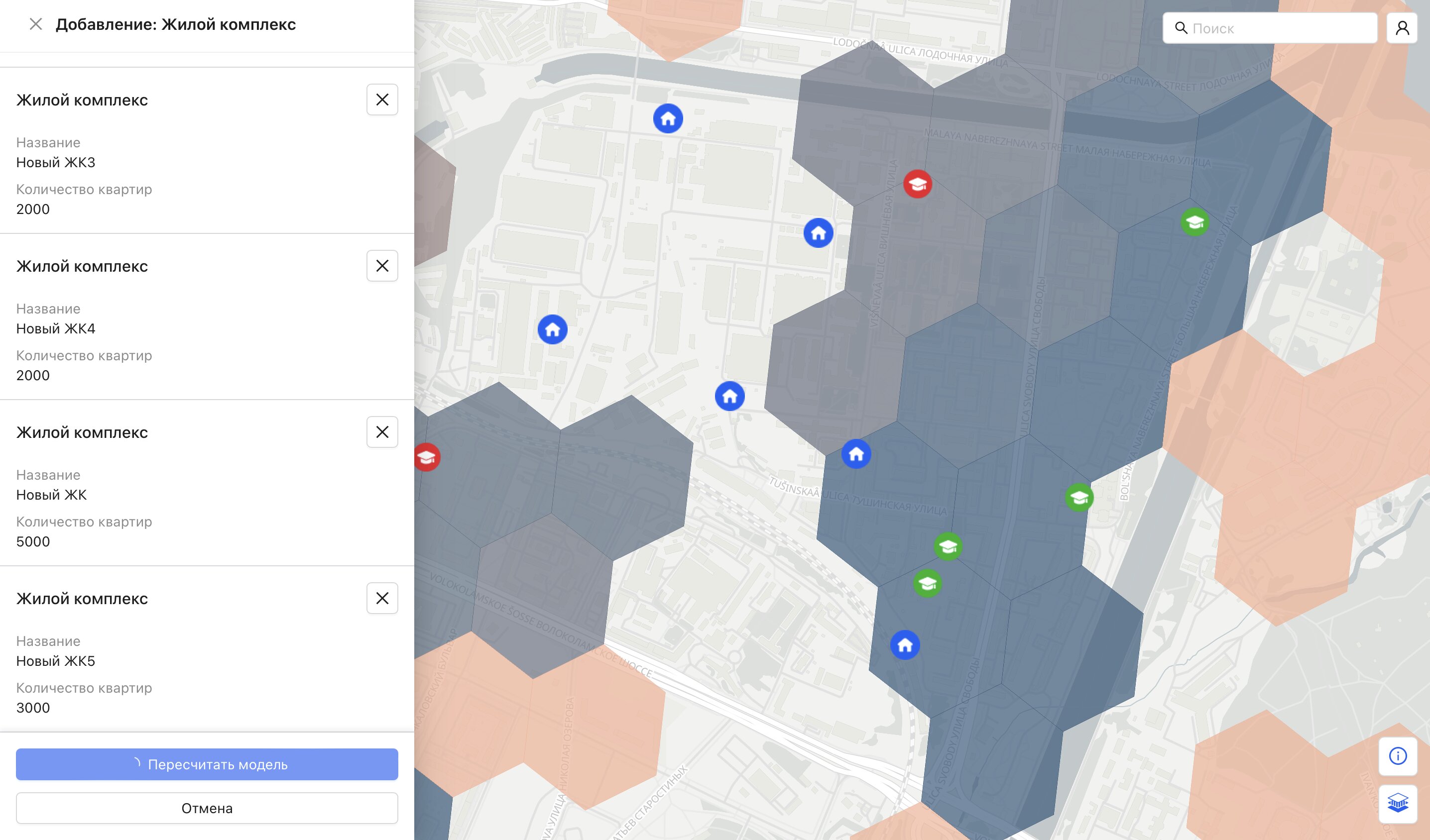
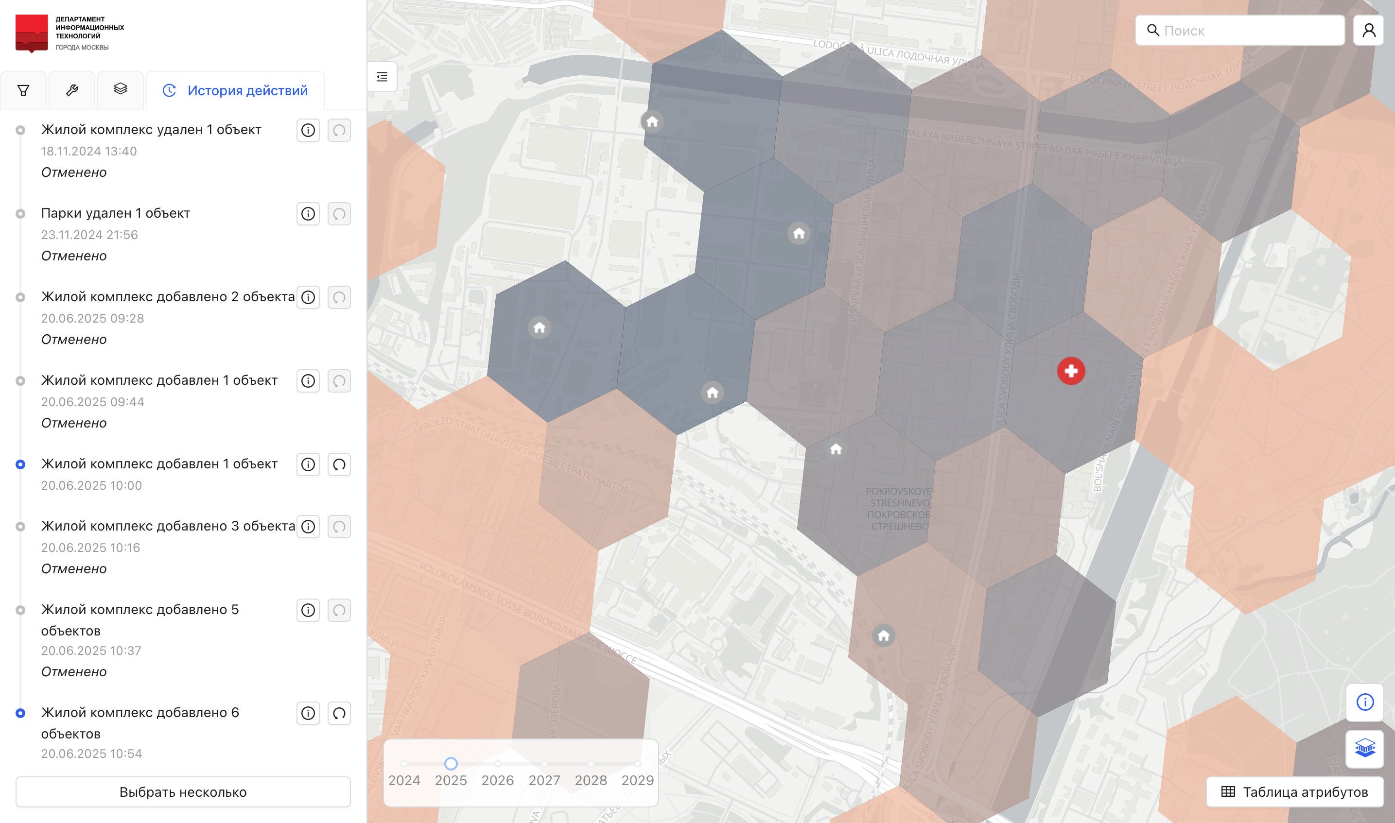
Besides simulating the construction and demolition of infrastructure facilities, the system also allows similar operations with residential complexes. For example, you can assess how the situation will change if a new residential complex with a specified number of apartments is built.
Let's build several large residential complexes on the industrial territory of the Pokrovskoye-Streshnevo district and evaluate how the situation with schools will change. The facilities in the district will become overloaded, and the population's provision will decrease.
All simulations performed by the user are saved in a history log. At any time, they can be canceled to restore the system to a previous or initial state.
The system is equipped with many filters that simplify the search for infrastructure facilities and urban areas with the desired characteristics. Using filters, you can quickly select facilities with a specific load and capacity, located in certain areas of the city, or urban areas with specific values for provision indicators.
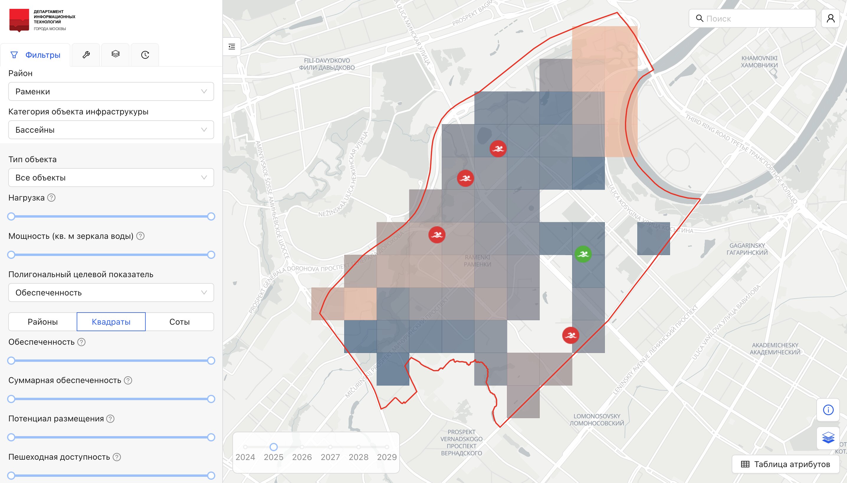
The system also allows you to choose the level of detail for displaying urban territories, from hexagonal cells with a side length of 200 meters to administrative districts